Nanxi River (nán xī jiāng 楠溪江) is located in Yongjia County (yǒng jiā xiàn 永嘉县) of Zhejiang Province (zhè jiāng shěng 浙江省). It is 23 kilometers from Wenzhou City (wēn zhōu shì 温州市), with Yandang Mountains (yàn dàng shān 雁荡山) on the east, the Xiandu (xiān dōu 仙都) on the west and the Xianju (xiān jū 仙居) on the north. The river is a famous state-level scenic spot with a total area of 625 square kilometers. It was praised as the Cradle of Chinese Landscape Painting (zhōng guó shān shuǐ huà de yáo lán 中国山水画的摇篮).
Nanxi River is famous for its clean water, rare rocks, waterfall, ancient villages and shoals. The main scenic spots of the Nanxi River area include the Baizhang Waterfall (bǎi zhàng pù 百丈瀑), the Furong Triangle Rock (fú róng sān yá 芙蓉三崖), the Waterfall of Tengxi Pool (téng xī tán pù 藤溪潭瀑), the Twelve Peaks (shí èr fēng 十二峰), the Taogong Cave (táo gōng dòng 陶公洞), the Warehouse Under The Cliff (yá xià kù 崖下库), the Furong Ancient Village (fú róng gǔ cūn 芙蓉古村), the Peace Rock (tài píng yán 太平岩) and the Lion Rock (shī zǐ yán 狮子岩), etc.. Generally speaking, the scenic area can be divided into seven parts, including Nanxi River, Daruo Rock (dà ruò yán 大箬岩), Shiwei Rock (shí wéi yán 石桅岩), Water Rock (shuǐ yán 水岩), Sihai Hill (sì hǎi shān 四海山), Dou Gate (dǒu mén 陡门) and North Vally (běi kēng 北坑).

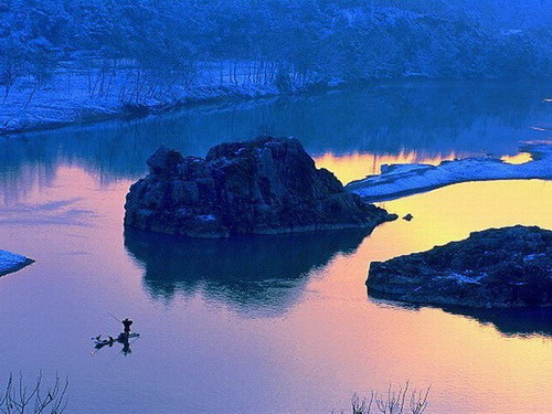
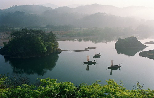
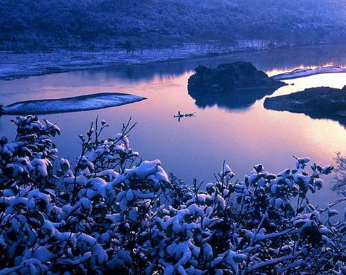
The sinuous Nanxi River has 36 bends and 72 beaches, with a drainage area of 2,429 square kilometers. It is flowing through the entire region of Yongjia County of Wenzhou. Running from north to south, the Nanxi River first flows into the Oujiang River (ōu jiāng 瓯江) and finally empties into the East China Sea (dōng hǎi 东海). The beauty of Nanxi River is that it is well preserved in its originality and nature. It was praised by experts as the Best Water under Heaven (tiān xià dì yī shuǐ 天下第一水). The water is limpid, crystal-clear and not being polluted. When looking into the river, you can see fishes swimming in the water. Also you can see the reflections of the trees on both sides. Upon examination, the sand content of the river water is just 1/10,000g per cubic meter and the pH value of the river water is about 7.
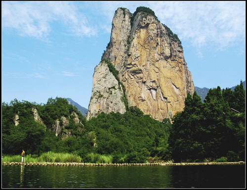
In the upper reaches of the Nanxi River, you can see waterfalls and ponds everywhere, like the Baizhang Waterfall, the Luoyang Waterfall (luó yáng pù bù 罗阳瀑布), the Shy Waterfall Under Cliff (yá xià kù hán xiū pù 崖下库含羞瀑), North Vallyhhvb and the Three-Bend Waterfall (sān zhé pù 三折瀑), etc. The rare rocks here are very appealing too. For example, the Peace Rock, the Triangle Rock of the deep pool (shēn tán níng bì sān jiǎo yán 深潭凝碧三角岩), the Lion Rock, the Chaotian Tortoise (cháo tiān guī 朝天龟), Shiwei Rock and Twelve Peak.
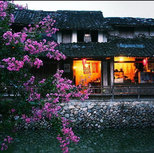
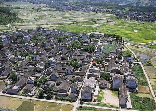
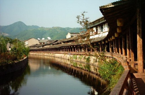
Apart from the water and rocks, there are many ancient villages which are hidden among the green forest. The villages preserve historical features and many traditional cultural relics. Here, you can learn about the evolution of farming and patriarchal clan in ancient <st1:country-region w:st="on">China. Furthermore, the layout of most of the villages follows the unique traditional culture of <st1:country-region w:st="on">China. Of all the villages in the scenic area, Furong Village is the oldest one. It has a history of more than 1,200 years. The village is square and faces east. There is a Furong Pond (fú róng chí 芙蓉池) in the middle of it. The pond is 43 meters long and 13 meters wide, commonly named Dadou (dà dòu 大斗). Cangpo Village (cāng pō cūn 苍坡村) and Yantou Village (yán tóu cūn 岩头村) are also very famous.

Nanxi River is not only famous for its beautiful sceneries, but also for the relic site of Neolithic Age (xīn shí qì shí dài 新石器时代) and ancient architecture of pagodas, bridges, kiosks, stone archways and battlefield relics, which are from Tang (táng cháo 唐朝), Song (sòng cháo 宋朝), Yuan (yuán cháo 元朝), Ming (míng cháo 明朝) and Qing Dynasties (qīng cháo 清朝). <st1:country-region w:st="on">China cultural heritage like traditional geomancy, ancient stationery and old family genealogies are invaluable materials for history lovers and scholars.